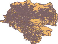
- Title
- Addis Ababa city Land Use
- Abstract
Source: GII
Projected Coordinate System: Adindan_UTM_Zone_37
- License
- Public Domain (PD)
-
+ Works in the public domain may be used freely without the permission of the former copyright owner.
+ For more info see http://www.copyright.gov/help/faq/faq-definitions.html. - Publication Date
- April 6, 2020, 8:40 a.m.
- Type
- Vector Data
- Keywords
- features land_use
- Category
- Planning Cadastre
- information used for appropriate actions for future use of the land. Examples: land use maps, zoning maps, cadastral surveys, land ownership
- Regions
- Global, Africa, Central Africa, East Africa, Ethiopia, North Africa, Sudan, Asia, East Asia, South Asia, Pacific
- Approved
- Yes
- Published
- Yes
- Featured
- No
- Group
- Covid19
- Name
- Tsegaye Ayele (tsegaye)
- tsegayeayele840@gmail.com
- Position
- Data Administrator
- Organization
- SSGI
- Location
- +251 Addis Ababa ETH
- Voice
- 0913121330
- Fax
- Keywords
- tse
- Spatial Extent
- ---
- Projection System
- EPSG:20137
- Extension x0
- 460199.440400001000000
- Extension x1
- 489606.096100000000000
- Extension y0
- 976208.153000003000000
- Extension y1
- 1005635.900100000000000
- Maintenance Frequency
- Frequency Of Maintenance For The Data Is Not Known
- Restrictions
- formal permission to do something
- Purpose
COVID 19 mapping and Analysis
- Language
- English
- Supplemental Information
No information provided
- Spatial Representation Type
- vector data is used to represent geographic data
- Name
- Tsegaye Ayele (tsegaye)
- tsegayeayele840@gmail.com
- Position
- Data Administrator
- Organization
- SSGI
- Location
- +251 Addis Ababa ETH
- Voice
- 0913121330
- Fax
- Link Online
- /layers/geonode:land_use
- Metadata Page
- /layers/geonode:land_use/metadata_detail
- Thumbnail
- Addis Ababa city Land Use .png
- Tiles
- Addis Ababa city Land Use .tiles
- Legend
- Addis Ababa city Land Use .png
- Remote Thumbnail
- Addis Ababa city Land Use .png
- View in Google Earth
- Addis Ababa city Land Use .kml
- KML
- Addis Ababa city Land Use .kml
- GeoJSON
- Addis Ababa city Land Use .json
- Excel
- Addis Ababa city Land Use .excel
- CSV
- Addis Ababa city Land Use .csv
- GML 3.1.1
- Addis Ababa city Land Use .gml
- GML 2.0
- Addis Ababa city Land Use .gml
- Zipped Shapefile
- Addis Ababa city Land Use .zip
- PNG
- Addis Ababa city Land Use .png
- Addis Ababa city Land Use .pdf
- JPEG
- Addis Ababa city Land Use .jpg
- OGC WFS: geonode Service
- Geoservice OGC:WFS
- OGC WMS: geonode Service
- Geoservice OGC:WMS
- Name
- Tsegaye Ayele (tsegaye)
- tsegayeayele840@gmail.com
- Position
- Data Administrator
- Organization
- SSGI
- Location
- +251 Addis Ababa ETH
- Voice
- 0913121330
- Fax
- Keywords
- tse
