- Title
- LASAC_20220204_AA19
- Abstract
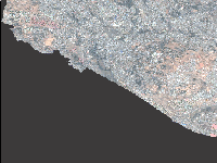
2m Resolution
RGB Band
- License
- Not Specified
-
+ The original author did not specify a license.
- Publication Date
- Feb. 29, 2024, 7:26 a.m.
- Type
- Raster Data
- Keywords
- aa19 GeoTIFF WCS
- Category
- Imagery Base Maps Earth Cover
- base maps. Examples: land cover, topographic maps, imagery, unclassified images, annotations
- Regions
- Global, Africa, Central Africa, East Africa, Ethiopia, North Africa, Sudan, Asia, East Asia, South Asia, Pacific
- Approved
- Yes
- Published
- Yes
- Featured
- No
- Name
- admin2
- endalkyz@gmail.com
- Position
- Organization
- SSGI
- Location
- Voice
- Fax
- Identification Image
-
- Spatial Extent
- ---
- Projection System
- EPSG:32637
- Extension x0
- 462536.692181858230000
- Extension x1
- 467535.654054310500000
- Extension y0
- 988370.155255076100000
- Extension y1
- 993369.117127528400000
- Language
- English
- Supplemental Information
No information provided
- Name
- admin2
- endalkyz@gmail.com
- Position
- Organization
- SSGI
- Location
- Voice
- Fax
- Link Online
- /layers/geonode:aa19
- Metadata Page
- /layers/geonode:aa19/metadata_detail
- Tiles
- LASAC_20220204_AA19.tiles
- Legend
- LASAC_20220204_AA19.png
- Thumbnail
- LASAC_20220204_AA19.png
- Remote Thumbnail
- LASAC_20220204_AA19.png
- View in Google Earth
- LASAC_20220204_AA19.kml
- KML
- LASAC_20220204_AA19.kml
- GeoTIFF
- LASAC_20220204_AA19.geotiff
- GZIP
- LASAC_20220204_AA19.x-gzip
- PNG
- LASAC_20220204_AA19.png
- LASAC_20220204_AA19.pdf
- JPEG
- LASAC_20220204_AA19.jpg
- OGC WCS: geonode Service
- Geoservice OGC:WCS
- OGC WMS: geonode Service
- Geoservice OGC:WMS
- Name
- admin2
- endalkyz@gmail.com
- Position
- Organization
- SSGI
- Location
- Voice
- Fax