- Title
- Oromia Region Quarry Sites
- License
- Public Domain (PD)
-
+ Works in the public domain may be used freely without the permission of the former copyright owner.
+ For more info see http://www.copyright.gov/help/faq/faq-definitions.html. - Abstract
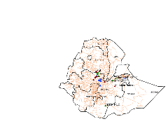
The map shows the Locational Distribution of Different Quarry Sites in Oromia. These places are where miners are in close contact. Its aim is to indicate awareness creation and follow up areas for the local health office.
- Publication Date
- May 26, 2020, 6:46 a.m.
- Category
- Imagery Base Maps Earth Cover
- base maps. Examples: land cover, topographic maps, imagery, unclassified images, annotations
- Regions
- Ethiopia
- Owner
- Space Science and Geospatial Institute(SSGI)
- Group
- CovidDataMgt
- Language
- English
- Supplemental Information
No information provided
- Spatial Representation Type
- vector data is used to represent geographic data

Comments (0 total)
Log in to add a comment